Labour day long weekend part 2

After my activations the previous day, my plan was to activate four mountains along a ridge, starting with VK3/VE-152, then VE-116, then VE-108, finishing up at VE-106.

VK3/VE-152

I started off fairly early in the morning from the Granny’s Flat campsite. The track I was planning to use on the map went through private land and was not available. It was not clear on the forest explorer map, but I guessed that there would be access to the spur track from here, and this proved to be the case. First was a river crossing:

Jamieson River crossing at Granny's Flat

Jamieson River crossing at Granny’s Flat

After crossing the Jamieson River, it was steep climbing on foot on a 4wd track up on to the ridge. It was hard going, up and down. I was glad I was off in the early part of the day while it was still cool.

The 4wd track approaches, but does not enter the activation zone, so I headed up to about 10m underneath the summit and set up the 40m end fed on the 7m squid pole. It was a bit temperamental, giving some very high SWR readings, on what is normally a very reliable antenna. I did get it to settle down and activated on 40 and 20 untuned. I used the KX1 tuner on 30, and it had little difficulty – however I got no contacts here. It was nice to at least get 2 DX contacts on the end-fed on 20, N1EU and EA2DT.

VK3/VE-116

This summit is quite a bit higher than VE-152, but first I have to head down to the saddle between them. It was about a 400 vertical metre climb up from there to the summit. About 300m of this was on track, with the last 100m off track, heading up the spur to the summit. This climb was quite difficult, and perhaps my fitness was a little lower than what it used to be. A few bike riders and 4wds went past, amazed that anyone would walk the track – “it’s hard enough to ride/drive” they said.

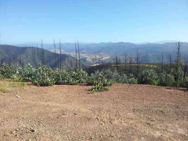
There were some moderate views between the trees on the summit. It is not heavily forested but no clear views. I again set up the end fed, but it only presented high SWR. Lucky I brought the random wire, but then I found that the wire had broken off the BNC adapter. The wire is quite thin and thus fragile. I held it in place with a finger to ensure that I could actually activate the summit. I went off the air a few times during the activation while doing this, and the squid pole also came down a few times. Not my most pleasurable activation! I at least got it done with 5 contacts on 40. Not too much time to do other bands so I could try to stay on schedule.

VK3/VE-108

Again, this summit was higher, but first I have to descend from VE-116 to the saddle. I headed north east down the spur and met the road about halfway down to the saddle. The climb took some time – the previous climb up VE-116 had taken a lot out of me. The 4wd track goes right through the activation zone on this summit, so that was a bonus. Once up the top, I decided that the fourth summit for the day: VE-106 was beyond me for today. I would not have had enough food or water to get there comfortably, plus I was tired.

I ended up operating mainly on 40, with only token efforts on the other bands. I could not spot, so I relied on chasers being able to pick me up. I held the random wire in here by using a rubber band! It worked much better than trying to manually hold the wire onto the BNC adapter terminal, like what I did at the previous summit. One shame here was heavy QRM on my VK1SV contact. Another station would transmit over him (he was fairly weak to me). The QRM station was about 579. They would time their transmissions only at the time when he was sending his report (and trying to zero beat him as well – so there was no doubt it was deliberate QRM specifically targeting our QSO) and then stop. When I asked for a resend a couple of times, they kept doing the same. I don’t get what the point of it is. Anyway, I had enough confidence in what report VK1SV had sent to log his report, so Mr QRM missed out on scrubbing the contact.

With that, it was time for about a 4 hour walk back to the campsite and a good overnight snooze.

VK3/VE-191

My next summit was a hill to the south of Jamieson. A track heads up from the town, approaching from the Northwest. It was a moderate grade, with only a few short steep sections. A softroader could have got up here with care. I enjoyed walking this track after the previous day’s work. I made my way up to the summit, just a little off the road. The road itself goes through the activation zone.

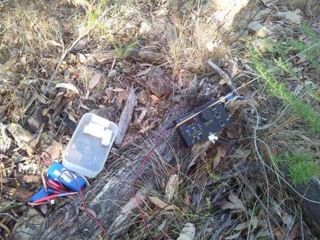
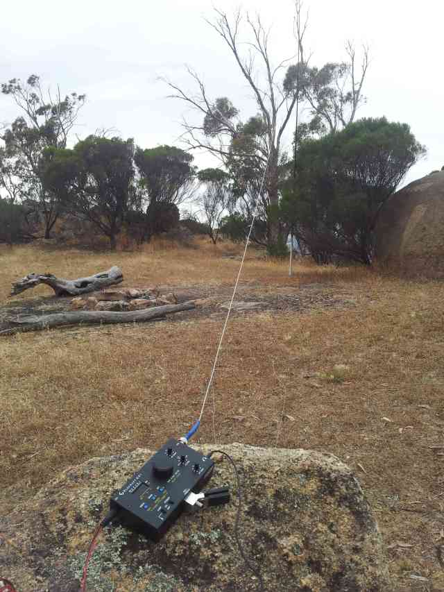
I took a photo of my jury-rigged random wire antenna at the KX1:

Jury-rigged antenna on the KX1 at VK3/VE-191

Jury-rigged antenna on the KX1 at VK3/VE-191

I had no takers on 20/30, so with enough contacts, I headed back down the hill.

Mt Terrible Sput VK3/VE-134

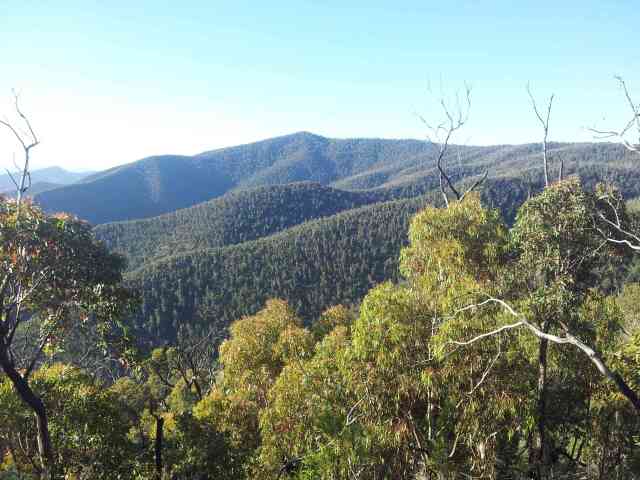
My two final summits of the trip were summits that I had activated before. The first was Mt Terrible Spur. First, on the way up was a nice view of the Goulburn arm of Lake Eildon.

Lake Eildon near Jamieson

Lake Eildon near Jamieson

Last time I was here, I drove the Prius, and could not get it up the hill. This time I was driving the Camry, and I got this 2wd up the Mt Terrible Road to the VE-134 summit area and parked a little out of the activation zone. It was another straightforward activation, using the random wire antenna on the 7m squid pole. The 1/4 wave counterpoises I have for 20/30/40 all seem to work well, and the KX1 can generally tune the antenna comfortably down the bottom of the 40m band. I am still getting about 1-1.2 watts output on an input voltage of about 12.3V from LiPOs and 0.8-1w on 10.4V from the NiZn batteries. There is some power being lost across the tuner on 40. The effect is less on 20 and 30.

Bald Hill VK3/VE-137

The final summit was Bald Hill. I was not able to get the Prius up last time, but the Camry made it with relative ease. I had to stroll out of the activation zone and back in again and setup at the highest point I could find. My rubber band jury rig antenna connection was still working, and I worked a number of stations on 40, and VK6NU on 20.

My plan to fix the random wire antenna was to use a higher grade wire for the connection to the BNC adapter, and solder on the thin wire to the higher grade wire (perhaps about 5cm of thick wire). This should help, because the highest level of stress on the wire is at the connector. It is twisted and turned as the radio is moved about.

All in all, it was a great long weekend, with 13 summits activated, 11 new uniques for me and 5 summits first time SOTA activated.

Regards, Wayne VK3WAM

Two summits in New Year 2014

Hi all,

After four gruelling days of action, which you can read about here:

Day 1: Mt Hedrick and Ben Cruachan

Day 2: Mt Margaret Range

Day 3: Cromwell Knob, Lamb Hill, Castle Hill and Bryce’s Plain

Day 4: Mt Darling Range

I was starting to get a little sore. Day 5 was clearly not going to be a big day to see in the new year. The previous evening, I finished up getting back mid to late afternoon from Mt Darling Range. I headed down to Horseyard flat to freshen up and then went onto Castle Hill Rd and Marathon Rd to head down towards the first summit for the day. Marathon Rd is a little rough in a 2wd, but not too bad. I don’t think the Prius would make it back up, its a one way trip for that kind of car. Anyway, the road soon improves and it did not take long to get to where I would stay for the night, near the first summit of the day.

VK3/VT-037

This is an unnamed summit that is close to Marathon Rd. Access is easy in a 2wd to about 450m from the summit and 130m vertical. From there, its a moderate scrub bash. It does not take too long to get up to the summit. The summit is forest, but reasonably open to put up antennas. Due to the scrub bash, I decided to leave the 7m squid pole in the car use the lightweight 4.7m pole instead. Scrub bashing with this is much easier, as because it fits in the pack, it does not get caught on anything either. Also, due to its smaller size, I often don’t need to secure the pole using a scrap. Just the tension on the antenna and some object, such as a rock is generally enough.

I operated, again using the KX1 using the end fed on the 4.7m pole. I was not able to convince Marshall VK3MRG to do a cross mode. I could tell that the summit 2 summit action was fast and furious, but most were SSB only. Ron VK3AFW decided to whistle back some CW to me, but this was after I reported on his SSB signal – this meant it was still a xmode QSO. Doing CW activations is not likely to result in being a leader on the summit 2 summit leaderboard, but SOTA should not be about being first on the leaderboards. I think that eventually I’ll lose the 1st positions that I currently hold anyway. My longer term objectives are to a) have fun, b) achieve Mountain Goat on uniques, and c) activate more than 600 VK3 summits.

I stayed on summit for the UTC midnight cross over, so I got the 6 activation points twice. After finishing up, I headed back down the mountain, at times using the compass (a real analogue one – the only ones I trust for real navigation) to ensure that I was heading east and not south east. Heading south east would result in me missing the road. In the end, I came out about 5m from where the car was parked.

VK3/VT-070

This is another unnamed summit, but time is ticking on this summit’s lifetime in the SOTA program. Perhaps 1 Feb, we’ll find out in due course. Nearby Mount Moornapa is the higher point with SOTA prominence and VT-070 does not have 150m prominence to it, so it will be leaving SOTA sometime soon. Nonetheless, I wanted to have it in the log before it is gone. I tried using the Link Rd from Marathon Rd to head east over Firestone Creek Rd, but that was not to be. Instead, I headed down Marathon Rd until reaching Valencia Creek Briagolong Rd and used that to hop on Firestone Creek Rd. This road is sealed for a while, and then good 2wd up to Ten Mile Track. Signs suggest that Firestone Creek Rd should be good through to Dargo (but not for towing a caravan).

Ten Mile Track is a little rough, but not too bad for the Prius. I was also able to get the car up the steep sections without any real trouble and this took me through to the Mt Moornapa summit. It was still fine going on Tower Link Rd through to a point to the south east of the VT-070 summit. I left the car here and proceeded on foot up to the summit.

One interesting aspect of CW activations on a KX1 is the ability to both hold the radio and key it in one hand. This meant I decided to operate in part standing up. Normally I am sitting on the ground when activating. Standing can make a nice change, especially if there is a bullant or two around. I was not bitten, but it was nice to be on my feet. Due to the short distance from the car, I decided to bring up the 7m pole. I think for 40m on the end fed, the 7m pole does not give too much above the 4.7m lightweight pole. Both do not give much DX joy with the inverted V too close to the ground. Some have had some DX success using dipoles such as doublets, but perhaps a 10m pole is really needed for that. I might have to get the vertical out a few times for real DX action, although the “random wire” has shown some limited promise.

I operated most summits over the 5 days on a set of 3S Lipo 2200mAh, x3 in parallel. They were still well over 90% at the end of the trip. I operated 3 summits just on the NiZn internal cells inside the KX1. They were still barely getting started. This nice little radio is well suited to these longer trips – it simply does not use much battery! With the NiZn cells inside, all I need is a random wire and something to have it off the ground, and that’s a complete station!

Back, at VK3/VT-070, the rain held off, but looked a bit threatening. I wanted to get out of any difficult roads while they were still dry, so I did not stay too long, and so my 5 day SOTA adventure came to a conclusion. A total of 12 summits (13 activations) with 9 of them activated for SOTA for the first time by anybody. 11 new uniques for me.

Regards, Wayne VK3WAM

Mt Margaret Range

Hi all,

vk3/vt-064

After my previous day efforts at Mt Hedrick and Ben Cruachan, I headed up and overnighted just off the Licola Rd where the 4wd track comes in from vk3/vt-064. This is at a saddle where the road climbs up to avoid the Macalister George. The 4wd track is certianly 4wd only, with good clearance and low range required. The Prius was left at the road and I proceeded on foot. It took just over an hour to walk the 3 and 1/2 kms to the summit. There is a bit of up and down on this track, so it is no pushover.

The summit was burnt in 2012, so there is good views along the Macalister valley.

Looking north up the Macalister valley from near Macalister George

Looking north up the Macalister valley from near Macalister George

I operated using a KX1 on 40, 30 and 20 metres using the halfwave end fed for 40 on a 7m squid pole. The KX1 tunes for 30 quite fine and I operate without the tuner on 20 and 40.

Mt Margaret vk3/vt-031

Next up Mt Margaret. I decided on using a walking track that rises up from the Tamboritha Rd. Its a climb of 850m, so it was going to be a big climb. The start of the track is marked on the side of the road, and cars can be driven about 200m to a nice parking spot under shade, although I didn’t know this and left mine in shade 100m down the main road. The track ends up in the creekbed for a while, and then climbs a spur. About 300m from and 150m down from the first knoll, it cuts across to the next spur coming into that knoll, which gives a bit of a break from the climbing. The track is reasonably distinct at this point, but above the first knoll, it comes and goes a little.

Things get tricky at the last knoll. From here, the track is much harder to follow: I could not really follow it. I stayed around the track alignment until the low point after the knoll and then went for the closest point on the Mt Margaret track. The forest had its moments, but it is reasonably passable.

There is no track that goes up to the summit itself. I went off track from near the east Mt Margaret 4wd track and walking track junctions, then straight up. I operated about 20 vertical metres down from the summit on the northern side to save a bit of time. Operation again was on the end fed, using the 7m squid pole and using the KX1.

vk3/vt-032

This summit would be quite easy in a low range, high clearance 4wd, as a track takes you right past. For me, it was a walk from Mt Margaret up the 4wd track to this summit. Operation was using the KX1 on the endfed mounted on the 7m squid pole.

I was using the KX1 on some 3S LiPOs for both yesterday’s and today’s activations. Even though I had spent quite some time calling, the LiPos were still well over 95% of capacity at the end of the day.

The end-fed performs quite well for local contacts. I had heard from around the band that some were finding 40m challenging. Still most reports were in the 529 to 549 range for me.

There were some nice views from up on the range. Here’s looking towards Wellington Plateau:

Wellington Plateau from vk3/vt-032

Wellington Plateau from vk3/vt-032

I then headed back along the 4wd track to the south, and then went off track to meet up with the walking track that I used earlier in the day, hoping to pick up the track at the high knoll. This was succcessful, even though my legs were getting a little sore from the scratchy undergrowth. There was a nice view looking back from near here towards vk3/vt-032.

Looking at vk3/vt-032 from the south in late afternoon light

Looking at vk3/vt-032 from the south in late afternoon light

I had taken 3 litres of water, after the previous’ day experience with 1.5l I still had to ration this a little back to the car, but at least I was nowhere as dehydrated as the day before. Day 2 of the trip down, next up doing summits around Cromwell knob.

Regards, Wayne VK3WAM

Mt Misery, Mt Kooyoora and Mt Bealiba

Hi all,

Up in Ballarat for a few days with the (out)inlaws. Without implying anything, its nice to slip away for a bit of SOTA action, especially to gain some new uniques.

Mt Misery VK3/VS-024

This is a summit that I have had my eye on for some time. It can be seen easily from the Western Highway between Ballarat and Ararat. Allen VK3HRA had activated it last year, so I was keen to follow and get it in the log. I gave one of the owners a call, and gained permission.

Access is via the Beauford-Waubra Rd. Stop at the Mt Misery Quarry sign NNE of the summit. You need to have arranged permission to proceed beyond this point. If the gate is open, don’t just enter anyway as you might find yourself locked in – which might be a problem if your car is on the wrong side of the gate, aside from the SOTA rules.

I met Chris, one of the owners, on the day. He is an old time farmer who doesn’t farm any more. He runs a fencing business but is looking to enjoy life a bit more.

I left the Prius near the hut about 300m NW of the summit. Chris was spending time working on bikes nearby. From there it was a straight forward climb up to a knoll to the west of the summit, and then a short steep section to the summit itself. There’s a trig on top and I operated from there.

At trig of Mt Misery VK3/VS-024

At trig of Mt Misery

The antenna tuned at the bottom part of the 40m band, so I operated from there. 40m on CW in VK is getting reliable enough for 4 SOTA contacts fairly quickly. I also operated on 30 and 20, which give better access for VK5 and northern VK2. I was hoping for some DX, but not today.

On a clear day, a lot can be seen up from here, so Chris tells me, and I have no reason not to believe him. For today, there was a nice view of inversion clouds at Mt Cole.

Looking towards Mt Cole from Mt Misery

Looking towards Mt Cole from Mt Misery

For those wanting access – here’s the sign:

Mt Misery quarry sign

Mt Misery quarry sign

Ring the first number on the sign for Steven and he can give you the relevant details from there.

Mt Kooyoora VK3/VU-007

I had first planned on doing this summit on a trip in July, but it was not to be then. The forecast for today was for showers and for conditions to be cooler. This was a good thing, because while Ballarat was 20 degrees today, here was 30. The showers did not really happen either.

I accessed from Mount View Rd from the south. Turning left off this at 409472 allows a short drive up (turn left at the next junction) to 1100m from the summit at the Crystal Mine carpark and its mostly off track from there heading northwards. The land falls for a few hundred metres, but not much. It then climbs up about 120 vertical metres to the summit. It is fairly easy off track walking. A big squid pole can be a mild annoyance, but I’ve took my 7m pole through far worse than this.

The antenna preferred to tune at the top end of 40, so I operated from there. It was nice to get a s2s with Peter VK3PF, but it was Xmode to get it. Seems funny to send a 59 signal report using CW, but I thought it better not to try to rate Peter’s voice tone – what would we rate it on? 1 for really angry to 9 for really happy?

Ian VK5CZ sent me a photo of his outdoor operation, so I sent him a photo of the shack:

Operating at Mt Kooyoora

Operating at Mt Kooyoora

The 7m pole is nice, but it does not really add a whole lot of antenna improvement vs operating on the lightweight 4.7m pole. I think what I will do is plan to use the 7m pole where I am expecting either a walking track or easier off track access to the summit, and take the smaller pole where more challenging walking is expected.

I also might prepare a 1/4 wave counterpoise for 40, but I might only take it and use it where using 7200 to 7300 is expected to be an issue – eg where a band plan either discourages using CW there, or the band plan has the force of law and prohibits it, or it’s a country that does not have 7200 to 7300 at all (eg the UK).

It’s a lot browner up here than last week in the Victorian High country:

Looking south from Mt Kooyoora

Looking south from Mt Kooyoora

Mt Beiliba VK3/VN-026

Last summit of the day was Mt Beiliba. Last time I was here, it was also the last summit but it was pouring with rain. Thought I better leave it. Now, conditions were far more pleasant.

In accessing this summit, it pays to have a good map. There are many roads in the State Forest area that go all over the place! Good access can be had by taking the Beiliba range track turning left off Log Bridge Trk at 354234 and then turn right at 353231. I tried taking Log Bridge Trk further, but ended up parking at 346233, which left me a 350m easy off track walk on very open forest to pick up Beiliba Range track, just as it started to get steep. No matter, it really just cost me 350m as there is no way I would the Prius up the steep section. I would think a low range 4WD would be required.

There are two high points, Mt Beiliba and a point north of there, about 400m away. All of it is in the activation zone. I actually went to the designated summit and operated from there.

As par for the course, the antenna liked the top end of 40m more. There is enough interest to get a CW activation done on weekends quite quickly on 40 these days. It feels much better than even the early days of SSB SOTA.

With that, and late for dinner, time to go home.

Regards,
Wayne VK3WAM

Preparing the KX1 for SOTA battle

Hi all,

Elecraft KX1

A few months ago I picked up a KX1 from a EDMRC club member who was selling. The unit came built and fully equipped, with the inbuilt ATU, the 30 and 80 band board and the keyer. The KX1 is a CW only rig but designed especially for portable use. With my mountain goat status out of the way, I wanted a CW specific and more light weight setup.

Rik VK3EQ (VK3KAN) had shown me a very lightweight squid pole at the 2013 Gippstech. I was quite interested in this because it packs up to 60cm in length. It has a 4.7m length when extended. Perhaps the top segment is too light duty to hold anything but a vertical wire, but the next segment down should handle at least a lightweight inverted V configured wire.

Random length wire antenna

Elecraft recommend that the KX1 ATU unit be used with “random length” wire, so long as the wire is not 1/2 wave length on the desired band. Note the reason for this is that the internal tuner is not always able to match the high half wave impedance.

I decided I wanted something serviceable on 20/30/40. After looking around at various web sites, such as this one, I settled on a 41 foot or 12.5m wire length. This is more than 1/4 wave length on all these bands, and around 5/8th wave length on 20. Should be a good “Aussie allrounder” but performing best on 20.

I bought some cheap speaker wire from a hardware store for construction and separated the two wires, but keeping the insulation. I stripped back some insulation at one end and doubled back to crimp a BNC pin. I then made two lengths of wire from the spare speaker wire for a counterpoise. One is 1/4 wave length for 20, the other quarter wave length for 30. 40 misses out, but at least both the counterpoises are 1/8th wave length or longer for that band. I crimped one exposed end of each of these to the shield on the BNC connector.

To give some mechanical security to the BNC connector, I taped about 7 or so cm of the three wires together, starting at the crimp. At least at this early stage, it seems to work well. We’ll see how it goes in the field.

The idea with this antenna is that there is no feedline. The antenna begins at the BNC connector – it is literally being fed right out the radio. The other end of the wire could be put up a tree and/or having the other end or middle of the wire on the squid pole. The counterpoise wires go on the ground.

"Random wire" BNC connector with 12.5m wire and 20/30 counterpoise

“Random wire” BNC connector

Mounting the wire on the squid pole

For the squid pole, I cut a small wood mount piece with a 1.5mm hole for a wire to use to wind the antenna wire around. I drilled a 3.5mm hole to mount the piece on the squid pole. This ends up about half way on the second highest segment. The top segment would be too weak for this kind of work, I think even only the bottom half of the top segment would be strong enough even for a vertical only wire.

It sits on quite nicely.

Wire mounting on lightweight squid pole

Wire mounting on lightweight squid pole

The wood mount is quite small:

Size of wood mount compared to my hand: it is about a finger width

Size of wood mount compared to my hand

The piece is small enough to be packed up in the squid pole case cap. The squid pole itself is small enough to go inside most larger packs, and even 40l hybrid type packs.

A basic test suggests that the squid pole will be able to keep the wire up in the field. We’ll see. If need be, I just need to make the hole a little bigger and it will mount a little lower on the pole.

Testing with the KX1

My initial test was at home. My house is two story, but the upper story can look down on the lower story. I draped the wire from upstairs to down, with the two counter poises on the floor upstairs. Not the best setup, and looking forward to trying it in the field.

The KX1 was able to tune the antenna on all bands, although the result was emergency use only marginal on 80. SWRs were 1 to 1.1 on 40 and 20 and around 1.5 on 30. The KX1 also shows realised power from the tune – which is quite interesting. The 20 match was showing full power (about 4 watts), with the 30 match around 2.8 watts and the 40 match about 2 watts.

I would expect better results in the field when this antenna is setup properly, with the random wire fully extended and the counterpoises at a greater distance from the wire and fully extended on the ground themselves. We’ll see, but none-the-less, early results look promising.

The whole system weighs less than 1kg, including the squid pole. It is my most light weight setup yet. If not for the squid pole, it could even get close to the station you can carry around in a pocket (or two).

I’m keen to give this a go on a SOTA summit or two over the next few weeks. Perhaps the FT-817 and the bigger squid pole and end-fed will come along as a safety net to make sure if this falls over, I’ll still be able to activate.

73 de Wayne VK3WAM

POSTSCRIPT: First activation with this setup can be read here.

3 summits and Mountain Goat

Hi all,

After last weekend’s effort I was on 985 Summits on the Air activation points. 1000 points is the level of the pinnacle activator’s “Mountain Goat” award. I had been quite busy recently, but I was keen to finally get enough points to become eligible for this award.

Some time ago, I had identified three summits, including Mt Duffy, as suitable for an activation, but due to fire burning, there was no available access method. Now, the 18 points they offered would be enough to get Mountain Goat.

Point 951 VK3/VN-010

First up was the northernmost summit. I headed up the previous evening and the plan was to sleep in the car. I would access via Gum Top Rd which passes over Mt Duffy. Gum Top Rd branches off Eildon-Warburton Rd at 093102. It is quite passable in a 2wd. The road generally follows the alignment as shown in Forest Explorer, except that the road does link up through to Mt Duffy at the Harry’s Track junction. OziExplorer maps show the link. I was able to get the Prius through quite easily in after dark driving. I continued onto Dray Track. Again, this section is passable with care in a 2wd. There is one steep descent (ascent coming the other way). It did not look too steep going down, but we would be finding out coming the other way later!

I proceeded to point 163558, where a 4wd track comes down from VK3/VN-008, and setup the mattress and sleeping bag in the back of the car. The 2004 model Prius has just enough room back there with the back seats down to fully stretch out.

Next morning, out with the pack and up to VK3/VN-008. There is no track marked on Forest Explorer, but OziExplorer shows the alignment. There is a rougher track heading down the north east side of that summit, and then it climbs up the VK3/VN-010 hill to point 182568. From here, head along the ridge. There is a very old overgrown track here. Keep to the centre of the spur, and it will be picked up fairly soon. This old track makes for easier access for the last 500m to the summit.

I arrived and started activating at around 8am. People are still getting up that time of morning so there was no big pile up. It was still a comfortable activation. These days with an efficient setup, there is no endless calling on 40m and not getting anything, if the band is at all open.

Here’s the end fed antenna at VK3/VN-010:

Antenna at VK3/VN-010

Antenna at VK3/VN-010

VK3/VN-008

Access to this summit was simply retracing my steps back from VK3/VN-010. Back to the track at point 182568. Oziexplorer shows this track continuing down the hill to the nor-northeast but it looks very overgrown. I headed back down the steep hill and climbed up to VK3/VN-008. I operated from the track, mounting the squid pole against some saplings from the 2009 fire.

Signals here were up on VK3/VN-010, but it happens as band conditions change. With a good cloud warming end fed on 40m on a 7m squid pole, conditions have to be pretty terrible on 40 for there not to be any action.

There was also a moderate pileup. SOTA activations during the week still have plenty of chasers.

There were good views of Mt Torbreck VK3/VN-001:

Mt Torbreck VK3/VN-001 from VK3/VN-008

Mt Torbreck VK3/VN-001 from VK3/VN-008

I also could look over at Mt Duffy, the site of the third activation. Mountain Goat status awaits!

Mt Duffy VK3/VN-007 from VK3/VN-008

Mt Duffy VK3/VN-007 from VK3/VN-008

Mt Duffy VK3/VN-007

The final activation was at Mt Duffy. I got back in the car and headed generally southwards towards Mt Duffy on the Dray track. It was good going in the Prius, but the steep section awaited. I anticipated I would need a good runup. The Prius generates a lot of torque at low speeds with the electric motor, but this is not always a good thing as it causes the tires to spin, then the anti-skid control cuts the power. Makes getting up hills challenging. I needed to get the car up this hill, considering I came down it the previous evening. I was able to get up without too much trouble on the first attempt. After that, easy going to Mt Duffy. I parked the car in the activation zone about 200m from the trig point. I then headed down another road and came up an old fire break to the trig point. There is a little bit of controversy about “final access to the summit” being non-motorised, and what does this mean, but I like to leave the activation zone and re-enter it with all my gear non-motorised. Of course I note the SOTA MT’s concession to people with mobility disability not needing to do that, and I’m ok with that.

Anyway, I setup at the trig point. Before starting the activation, I took a video:

We also have some MP3 audio taken by Matt VK2DAG of the activation:
Audio recorded by Matt VK2DAG

With the activation done, it was back to the car and out on Gum Top Rd. It is easier going back to Melbourne via Marysville rather than by Warburton.

The SOTA 1,000 points does take a lot of effort in VK3. Many summits I’ve activated have been in the wilderness. While this means they might take a lot of effort, it only magnifies the fun. SOTA might seem an odd activity to some, but the comradely with other activators and SOTA chasers has been great. I look forward to many more SOTA activations in the future.

In recent months, I have been too busy to be able to do the multi-day pack-carry SOTA adventures that I have done in the past, but I look forward to sneeking in a few of these over the summer months.

I think with the Mountain Goat achieved, it might be time to shift gears a little and perhaps go back to a bit of 2m colinear usage, or perhaps brave taking out the Elecraft KX1 for CW only activations!?

Regards,
Wayne VK3WAM

Mt Buangor, Ben Major, Ben More

Hi all,

This weekend I had the chance to get out and have a look at a few summits. One, Mt Buangor was one I visited last year, but the other two were firsts for me, with one being the first ever SOTA activation.

Mt Buangor VK3/VS-003

This summit is quite easy to get to, even with a 2wd. The main Mt Cole Road passes within a few km, and the first turnoff road at 982712 is still an improved gravel surface. It climbs up to 979707. From here, the road is of lesser quality as one turns right and then left 150m or so further along. It is passable in a 2wd, but only if dry. On this occasion, there were two large puddles, the second of which I was not prepared to drive the Prius through. A Awd should handle it pretty easily. Even so, it was less than a 10 minute walk from here to the summit.

This year, it was out with the end-fed, the tried and true method of getting a quick activation. FT-817 in hand, I operated for about 20 minutes. Signal reports were a little down, but no real problems. It was good to be back on air after more than a month!

Ben Major VK3/VS-028

Onwards to new territory for me. I headed down the Mt Cole Rd to Raglan and then along the Chute Raglan Rd to 113695. Turning off to the right, there was a track, quite passable in a 2wd heading towards Ben Major in the state forest. I made my way along this to 142713, where I turned left. The road quality here was worse, but still passable with care in the 2wd. I made my way to about 500m shy of the summit and walked up about 50 vertical metres from there.

There was a trig point at the summit which I set up from:

Operating at Ben Major VK3/VS-028

Operating at Ben Major VK3/VS-028

Conditions on 40m seemed to have picked up here from Mt Buangor. Reports seemed to be 3 or so S points higher, both on Rx and Tx. Same general setup with the end fed.

From here, there was a good view towards Ben More, which was my last summit of the day.

Looking at Ben More from Ben Major

Looking at Ben More from Ben Major

Ben More VK3/VS-027

Ben More is slightly higher than Ben Major. There is a public park that approaches the summit itself, but does not quite make it. The summit appears to be on private land. The top part of the public land is well within the activation zone, about 5 vertical metres down.

The next trick is that there is no easy public access to this summit. There is, however a public road reservation that makes its way to the public park boundary. I communicated with Rob Brouwers, a ranger at Parks Victoria Maryborough office. He can be reached on 5461 0819. He highlighted that Impeys Rd then Joseph Lane continues to make its way further than marked on most maps and the reservation goes all the way to the Ben More Bushland Reserve. Along the way, the road goes through a gate with “Private – No Entry”, however the road reserve that continues past this sign is public land. If planning to activate, it may be useful to get in tough with Rob and get the access map emailed from him as to how to access the reserve.

A quick side note: Google maps shows the approximate line of the road reserve. There is no road for the last 1000m of this alignment.

The road ends up about point 172770. From here its on foot with the land climbing steeply. It’s just over 1km, however about 250 vertical metres, so get ready for a climb. Using the land boundaries map obtainable from Rob, you can aim to keep within the public reservation and try to prevent going onto private land. The road reservation is largely not fenced from this point. The boundary of the bushland reserve higher up is, and once in there, it is still a steep climb, but a little easier as you can more freely choose your climbing line on public land.

I operated about 20m from the trig point. The trig point itself is on private land. The closest public land is quite close, and I used the emergency marker there to mount the squid pole:

Operating at Ben More VK3/VS-027

Operating at Ben More VK3/VS-027

Looking east from Ben More

Looking east from Ben More

Looking north towards Blue Mountain range from Ben More

Looking towards Blue Mountain range from Ben More

With that, it was time to pack up, head back down the hill and carefully try to stay within the road reserve back to the car. It was a nice activation, but I felt it was important to have the Parks Victoria documents with me in case someone decided to challenge me being there.

Regards, Wayne VK3WAM

South Gippsland and Mt Matlock

Hi all,

Continuing to catch up on this blog.

VK3/VT-029

I was heading off on a three week trip to PNG, and wanted to sneak in a few SOTA activations beforehand. On the evening of the 5th of September I headed up the Woods Point Rd to the Thompson Jordan Divide Rd. This is a good 2wd road. I headed down to point 307297 and slept there the night.

Early the next morning, I passed through the seasonal closure gate on foot. It’s about 6km from the road junction to the activation zone. The track from here would be quite passable, perhaps even by a 2wd during summer or in dry conditions. The summit is quite unremarkable, perhaps Mt Easton, a few kilometres away, might give some views of the upper end of Thompson Dam.

Station at VK3/VT-029

Station at VK3/VT-029

There are not as many SOTA chasers during the week, especially early in the morning. It was never a problem getting the number of QSOs, but not the fast pileup today.

End fed at VK3/VT-029

End fed at VK3/VT-029

With that, it was back to the car and onto the next summit.

Mt Matlock VK3/VC-001

This mountain is in the central region. It perhaps does not belong, but because the associated local government area stretches out this far, central region it is. Last year, this summit was covered in snow, but it was a more civil affair this time.

Summit of Mt Matlock

Summit of Mt Matlock

It is quite possible to drive a 2wd all the way to the top. I left the car at the road junction about 300m south of the summit, then dropped a bit of height and walked up to the summit from there.

The activation was still a little slow with eight contacts. Not too many chasing today.

As I was able to drive further than expected, I was now getting ahead of my expected time schedule. Nice to keep a bit of time up my sleeve.

Mt Toorongo Range VK3/VT-026

Next up, Mt Toorongo Range. Many have been here since I was last, this summit seems be a quite popular place during bonus season.

I was able to get the 2wd all the way up to the seasonal closure gate. From here, it’s a fairly short walk. This time, I headed up to where the road levels off, and then head off track up to the summit. Easier going than last year.

Activity from here was a little busier than my previous two summits. This year, I was only doing 40m unlike last year where the colinear had a go. Finally, I had a look from here at the final summit of the day.

Mt Horsfall from Mt Toorongo Range

Mt Horsfall from Mt Toorongo Range

Mt Horsfall VK3/VT-028

The main road going to this summit is subject to a seasonal closure quite some distance from the summit. My plan was to approach it from the south and use a 4wd track that goes up the side of the mountain. I had heard that others could not find this track, so perhaps it does not exist – it would not be the first time a marked track does not exist.

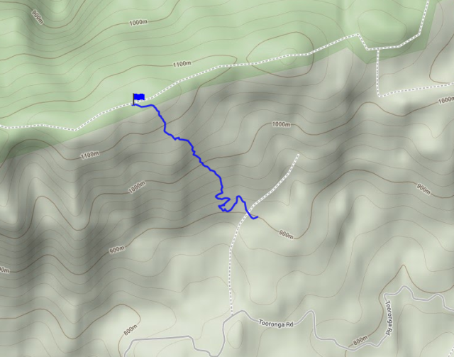
I used the Toorongo Rd from the link rd, travelling west to about 2km south of the summit. There was a track heading up from here, so I drove the car up. It was a little rough for a 2wd, but I travelled up about 800m to another junction at point 168183. From here, I tried heading north-east, but that track died out. I then tried the other track, and the tracklog is shown below:

Access to Mt Horsfall

Access to Mt Horsfall

The track starts off quite good, and makes it’s way across a creek. From there it winds up towards a lookout for a waterfall. The track is quite overgrown going through the zig zags, but still worth following. From near this lookout, I made a direct line towards the summit, going straight up. The forest is mostly passable, there’s a few tricky bits to try to avoid. I also picked up a leech or two, so wearing gaiters is a good idea. The off track section can be as short as 700m, so it is not too bad.

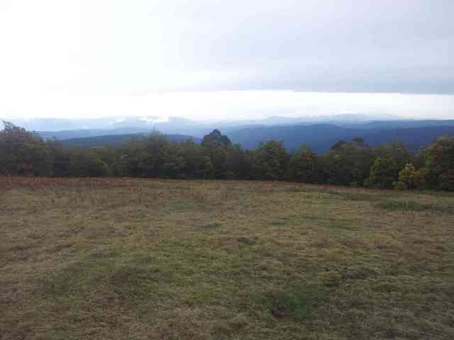
There are some good views up top, overlooking the forbidden forest of the Upper Yarra.

Looking into the Yarra valley from Mt Horsfall

Looking into the Yarra valley from Mt Horsfall

Even though there were a few clouds around, the rain held off until I was back in the car and driving home. Nice one 🙂

Due to the large grassy area, I chose to use the trig point to mount the antenna.

End fed antenna on the trig point at Mt Horsfall

End fed antenna on the trig point at Mt Horsfall

The end-fed is the ol’reliable. It, again, was not as busy as a weekend SOTA activation, but lots of good strong signals.

With that, it was time to head for home. Back in the car, well before dark.

Regards, Wayne VK3WAM
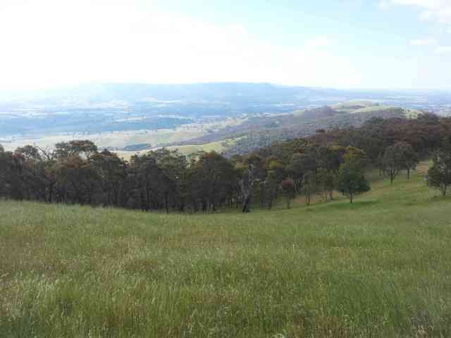
Northern Victoria 4 summits trip

Hi all,

I’ve fallen a little behind in maintaining my blog, so I will try to catch up over the next little while.

On the 19th of July, I headed up to Bendigo and gave a SOTA talk at the Bendigo Amateur Radio and Electronics Club. There was quite a lot of interest. I had previously telegraphed my intention to go out and activate a few summits the next day. A few guys from the club looked past the not so good WX forecast, although chances were it would be cold with a few showers, rather than heavy rain.

Joining me on this trip was:

  • Phil VK3BHR
  • Ray VK3YAR – who also kindly put me up on the Friday night, and
  • Col VK3LED

As it is a little while since the actual activation, I can’t remember everyone who accompanied us.

Mt Kerang VK3/VU-010

Proceedings opened with this nice little summit. The summit requires access over private land, and look at the following photo of the gate as to how to make the necessary arrangements:

Access gate to Mt Kerang

Access gate to Mt Kerang

Ray had already arranged to obtain a key, so we were able to drive to the summit. It is a walk for an hour or so if vehicle access cannot be arranged.

The summit itself is quite open. We proceeded down the north side to lose about 30m vertical and then turned around to head up, making sure we had carried all of our gear with us.

Here’s a few pics of proceedings from the summit:

Inverted V mounted on the trig point at the summit of Mt Kerang

Summit of Mt Kerang

Phil VK3BHR operating at Mt Kerang

Phil VK3BHR operating at Mt Kerang

The interesting thing about Phil’s rig is that it is a self-built, self-designed rig. Might be a bit heavy for some SOTA work, but impressive nonetheless.

Mt Korong VK3/VU-012

Next up was Mt Korong, after a quick stop at a fish and chip shop. This is on a public reserve, however there is not a maintained track to the summit. The forest is reasonably open. There are some nice views from this summit.

Looking south west from Mt Korong

Looking south west from Mt Korong

My end-fed half wave on 40m, plus the 2m colinear were in action at the summit.

Antennas at Mt Korong

Antennas at Mt Korong

The terrain is quite open lower down, so the best bet might be to park at the main car park. There is a track marked on some maps, but this is very faint and we did not follow it. Nonetheless, it is likely to be easier to head straight up from the car park, rather than trying to traverse in along the ridge from the west. This is a good mountain for those not so experienced in off track walking to get started.

Mt Tarrengower VK3/VN-023

After Mt Korong, the guys were looking for an easy one. There is a sealed road to the top. We parked down a little, and did a little trip down a valley to ensure we were low enough to be out of the activation zone on the way to the top.

Proceedings were similar to Mt Korong, with my end-fed, the 2m colinear and Phil using an inverted V on 40m.

Operating at Mt Tarrengower

Operating at Mt Tarrengower

Mt Ida VK3/VU-009

With that, I bid my Bendigo friends farewell, and headed for Melbourne, but via Mt Ida. I expected to get there well after dark and would try activating on 2m only. Access to this summit is quite easy in taking the road nearly all the way to the top. It looks to be within 25m vertical of the top, so dropping about 10m from the car park would be advised. The road in from the Northern Hwy can be a little easy to miss in the dark when coming from the south.

It was fully dark during this activation. I operated from on the corner of the fenced area using the 2m colinear. A highlight of this activation was a 2m FM contact with some enhancement with VK2KRR near Wagga Wagga.

With that, I packed up and headed back to Melbourne.

Regards, Wayne VK3WAM

Gippstech 2013 and SOTA activations

Hi all,

Last weekend I headed over to Churchill for a fix of VHF and up at Gippstech 2013. The weather was poor, so I did not bring any radio gear for activations afterwards.

Gippstech 2013

The conference was held in the usual place at Monash University, Churchill campus. It was quite interesting with topics from 50MHz to the latest adventures on 10GHz and up. The mm bands have come a long way in recent years.

Of course, on weekends there is a lot of SOTA activity. Certain persons were seen disappearing into the car park where squid poles and other items suitable for SOTA chasing seemed to be appearing:

Peter VK3PF and Rik VK3KAN discussing a lightweight 4.3m squid pole

Peter VK3PF and Rik VK3KAN discussing a squid pole

Rik VK3KAN grabbed a lightweight squid pole that is less than 50cm retracted and very light weight. This could go in all overnight packs rather than being outside. Hmmm, quite interesting.

Other people were caught out at times:

Ron VK3AFW chasing SOTA

Ron VK3AFW chasing SOTA

The weather was rainy at times, but a good time was had at conference and SOTA discussion with le tour on the TV at Peter’s. My chaser score went up over 15% just this weekend!

Mt Useful VK3/VT-016

As Gippstech wound up, I planned to head home, but after consulting the radar, the idea grew to head up to Mt Useful with Andrew VK1DA and Peter VK3PF for a bit of SOTA fun. It had been raining all morning and early afternoon, but it seemed that the WX was lifting. Peter also informed us that there was a shelter that we could activate from. This emboldened us, so into Peter’s Subaru for the trip up. The road is quite good quality, and quite passable in a 2wd pretty much all the way to the top. With the wet conditions, the road was a little soft in places, but careful driving in a 2wd would still get through. Peter had already activated this summit recently, so he dropped us off near the edge of the activation zone and then he drove to the summit. Andrew and I headed down a little just to be certain that we were out of the activation zone and then headed in (carrying all of the activation gear).

We used Peter’s squid pole and 20/40 linked dipole. One of the links had come out, so it was 40 on one side and 20 on the other. After discovering this, the signal came up and it was good signals all around.

VK3/VT-034

The road into Mt Useful passes another SOTA summit. Time was late, but this summit has a good path into the Latrobe Valley. Peter called some of his club members in the Latrobe Valley, who were willing to help us out on a quick 2m activation. We hoped to get to the summit before dark, but we were also uncertain if the access road was closed due to bushfires early in the year. We left the main Mt Useful Rd about 5km north east of the summit and headed across. The road is in good condition, again quite accessible in a 2wd. It goes right into the activation zone, but not quite to the top. We drove past the activation zone and parked about 35m vertical metres down from the top.

Conditions had cleared right up. We took turns, with two of us near the car, and one climbing up about 20 vertical metres to get well into the activation zone. Peter’s mates were good signals in, plus by taking turns, each of us also chased the summit. We decided not to use 40m, due to the approaching dusk meaning the skip zone would have been building by then. Also, we did not want to stretch the WX luck too far.

With that, it was 17 activation points – including three bonus points – from 2 summits. Not bad for a quick little side trip from the conference.

Regards, 73 Wayne VK3WAM