Hi all,
I have been progressively been working on visiting each of the summits in the upper Moroka area, and on this trip I wanted to check out possible approaches to Snowy Bluff VK3/VT-019, which would have to be close to Victoria’s most inaccessible but legally possible to get to summit.
Mt Kent VK3/VT-008
I proceeded up from Melbourne on the Friday night and made my way to Horseshoe Flat, which is a nice camping ground on the Moroka River a little more than one km after the Castle Hill turnoff on the Moroka Rd. It is quite well known, but the first question I had from people when I got there was ‘Are you lost?’. Maybe because I was not setting up an elaborate tent, I was just sleeping in the car so I could make a quick getaway at first light the next morning for what I expected to be a big day.
The next morning I continued along Moroka Rd and took the Shanty Hollow Rd turnoff. Small fallen trees meant I had to leave the car about 1km along, but a moderate clearance vehicle could keep going. The road would be good to reference 003576. A proper 4wd could drive up to the ridge below Little Kent. There is a track all the way to Mt Kent summit. The weather this morning resulted in a temperature inversion, leaving the valleys covered in cloud:

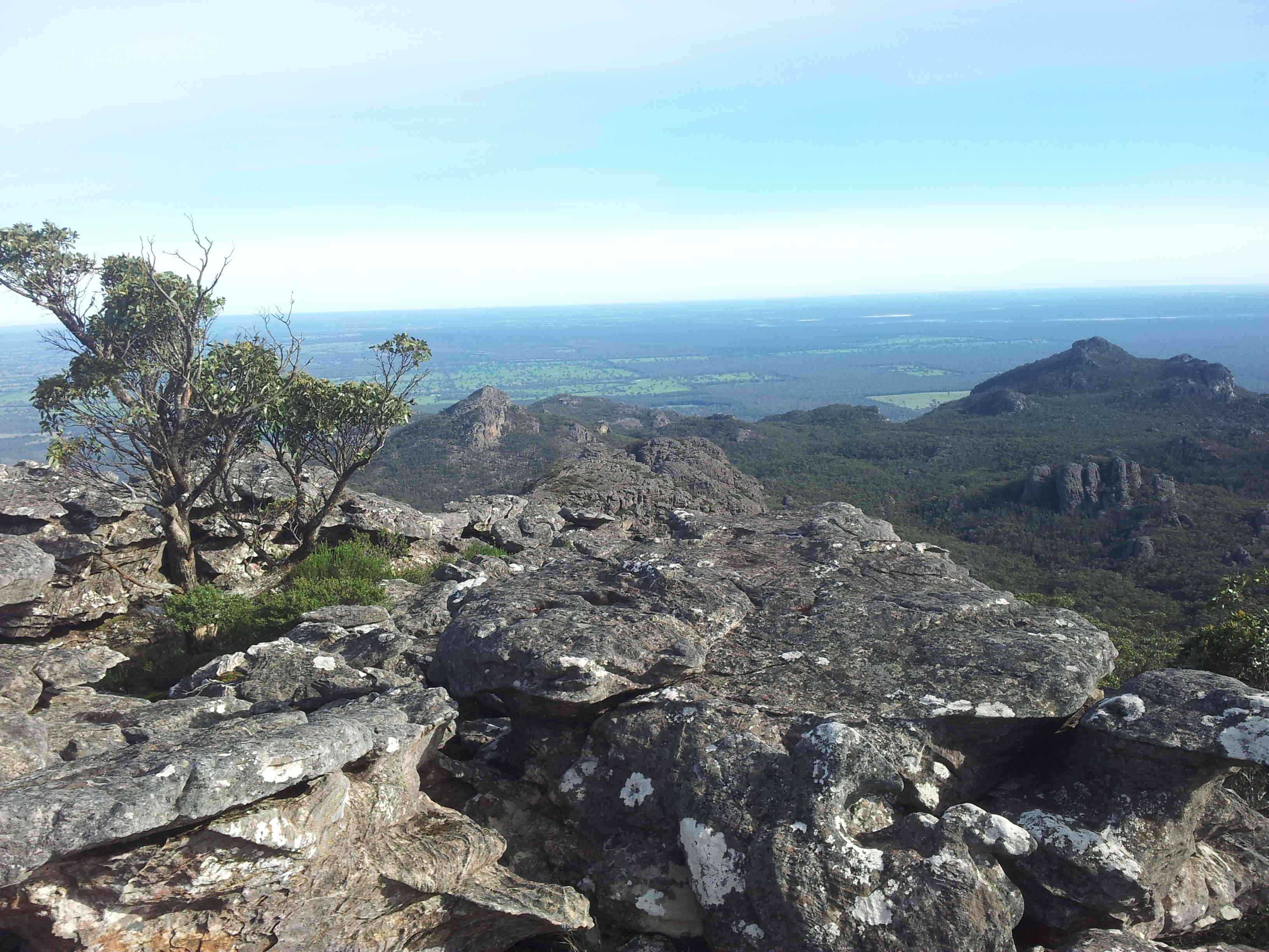
The view from near Little Kent
I took the FT-817 on this trip, and thought about doing some SSB, but it’s been so long since I had done SSB, I forgot the microphone. So back to CW. Better make sure I don’t forget the microphone when I go to Lord Howe Island.
For this trip, I introduced a new end-fed antenna. I had previously used a commercial end-fed, but the toroid in the match box had broken. I have to, at some stage open it up with a hacksaw and see if I can fix it. For this trip I used a SOTA-beams 20/40 matchbox. This matchbox has a variable capacitor that is controlled with a knob on the front. It is rated to QRP levels, which is fine by me using it with a KX1 or a FT-817.
I used some cheep Bunnings speaker hookup wire to build the end fed. To create some more robustness to the connection, I used three parallel 10cm runs at the connector, then soldered to the single run from there. One issue with these light wires is the physical connection strength as they take a lot of mechanical wear and tear at the connector. This is a similar approach to what I did with my “random wire”, with a short 5-10cm run of a stronger wire at the connector and then joining to the light wire.
The end-fed was fine on the short squid pole. I would turn the dial to where the background noise (what there is of it) sounded loudest and then continue fine tuning the capacitor using the SWR meter of the FT-817 until it shows no SWR. The dial was close to one end of range at 40 and close to the other end at 20. I could make a dedicated 30m end-fed, but that sounds like too much work. End-feds with their matchboxes are a nice solution for the FT-817, they don’t need a separate ATU. I like this SOTA-beams end-fed solution because it also allows connection of a counterpoise. I cut two 1/20 wavelength wires from the speaker hookup wire, one for 20m and one for 40m. Seems to work, and the match is generally better than the previous commercial product that was not adjustable and had no counterpoise.
Here’s a picture of the rig and the antenna connection:

Operating at Mt Kent
Mt Dawson VK3/VT-015
From Mt Kent, I headed off track to the south west. Older DSE based maps show a road making its way towards the saddle between Mt Kent and Mt Dawson. If I had my time again, I would have gone directly towards the saddle. A good view of Mt Dawson, and the ridge making its way north towards Snowy Bluff:

Mt Dawson
The road is in reasonable condition for walking to the saddle. Someone with a chainsaw would still be able to get a 4wd down it from Shanty Hollow Rd and the road has not been officially closed. The road from the saddle towards Mt Dawson has, and must have been closed much earlier. This old road is in a much poor state, but can still be followed up the hill. It would still be easier using it rather than going straight up off track. The track bypasses the summit to the south by about 400m. It’s semi alpine. The activation itself was fairly straightforward, but I was mindful of the long road bash back to the car. At least it was on track most of the way.
I certainly plan to come back here. I think going through Mt Dawson will still be the easiest way to get to Snowy Bluff.
Mt Valentia VK3/VT-017
After the long road bash back along Shanty Hollow Rd, I drove to the Castle Hill Track turnoff and got the Prius about 500m down the track before parking and continuing on foot. The alignment of the track approaching Mt Valentia does not really follow the map closely, in particular the road was not approaching the activation zone closely on the northern side. I left the road and went off track to climb about 40m to get well within the activation zone. It was getting dark and I could not spot.
I again used the end-fed to activate, and got one contact on 40. It was slow going but ultimately successful for at least getting the unique, but not the 8 SOTA points on offer. I think the moral of the story is that unless you can spot, or have the RBN spot you, evening activations on CW are much harder work. It felt like the early days of SOTA in Australia.
Nonetheless, three new uniques in the bag today (two of them first ever SOTA activations) and a much better idea of tackling Snowy Bluff. So a good day in all. I thought about activating some other summits on the next day, but the rain had come in. I had a bothy shelter for the rain, but I thought instead that I would head home early.
Thanks for reading, Wayne VK3WAM


You must be logged in to post a comment.