2014 ANZAC weekend activations Part 1

Hi all,

After being around Ballarat for Easter, I managed to slip away for a 2 day trip on ANZAC day and Saturday following. A chance for some solid walking for a few summits.

VK3/VT-018

I drove up Thursday night from Melbourne through Dargo and stopped the car about 400m from the summit and there slept the night. The following morning, it was walk down the road to get out of the activation zone and make my way up to near the highest point. The road itself (Dargo High Plains Rd) actually enters the activation zone, so this is one of the easier summits around.

My battle equipment for these sets of activations was the “random” wire, the KX1, the 7m squid pole and LiPOs to give me 12V: starting at 12.6V and never really gets much below 12.3V even over many activations! The LiPOs are 3 packs of 3S 2200mAh. I could get away with just one and that would be plenty, but I would like to use these three together over their life. They must be over 100 cycles by now, they have seen a lot of action. The boss approved use for these LiPOs was for powering an electric lantern, but I also had an eye on “dual use technology”.

Most contacts were on 40, but I managed to also get AX2UH on 30 and AX5CZ on 20. I was looking forward to using the AX call, if nothing else to have a bit of variety on the CQ morse key calling. Could I control myself in sending “AX” rather than “VK”? Would the strange callsigns throw me on RX? Turned out not to be much of a problem, but it is always good to keep the practice up.

Near Mt Freezeout VK3/VE-024

There had been some debate about whether this summit, or Mt Freezeout itself deserved the SOTA reference. The maps suggest that this peak is higher, and now having been there, I continue to agree. Access is reasonably straightforward from the Dargo High Plains Rd. Just to the south of Mt Freezeout is a bit of a campsite. It’s hard to miss to the east of the road. From here, head up Mt Freezeout, and it is best to go to the summit, rather than contour around. From the summit, head east towards the saddle with VK3/VE-024 and head up.

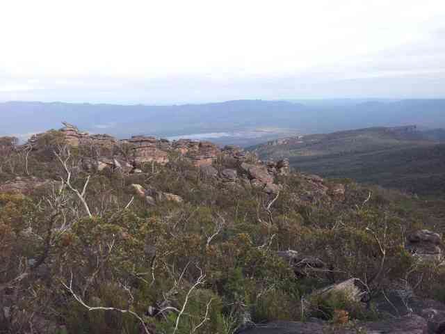
It is a bit stark with all the dead snowgums from the 2003 fires. There had been some recent fire activity which further set back the regrowth. The views are nice however:

Looking towards the Dargo High Plains from Mt Freezeout

Looking towards the Dargo High Plains from Mt Freezeout

The Twins and Mt Buffalo (in the background) from VK3/VE-024

The Twins and Mt Buffalo (in the background) from VK3/VE-024

I took the 7m squid pole, figuring that the bush bash would be very mild, which it was. Sometimes it gets caught in the burnt branches of the snow gums. I think that the 7m pole gives some marginal DX benefit over the 4.7m pole on the random wire (a little less cloud warming), but I’ve pretty much come to the view that if there is any serious off track walking now, that the 7m pole can either stay at home or in the car.

Here’s the antenna and pole at the summit:

Antenna at VK3/VE-024

Antenna at VK3/VE-024

I worked backwards for this activation, 20 first, then 30 and 40. Picked up Peter VK3PF on a s2s on 20. It would have been direct wave, because he was less than 50km way.

The KX1 has a s meter, but I don’t use it. What it does do is present received signals with a slightly dampened AGC, so differences in strength can be heard. AGC is still present in the radio – There is a 48dB difference in strength from S1 to S9. A radio like the FT-817 has AGC action that completely removes any audio volume difference between an S5 signal (reported by the FT-817 as below S1 – a SOTA activator could be deceived to report this as a *cough* strong 509 signal) and a S9 signal. On the KX1, S6 signals are about the same volume as my sidetone setting. S9 is starting to blast my ears – although I’ve changed earbuds recently which have improved things. Below S3, I have to turn the volume up to better hear the other station, but turn it down on TX so the side tone is not too loud.

After finishing up, it was on to the two last summits of the day, with significant walking planned.

Mt Blue Rag VK3/VE-021

The 4wd track was beyond the Prius – I didn’t try – but I reckon I could have given it a shake in the Camry. I walked up to the top of the main track and then found side tracks heading along towards the summit itself. A small amount of height is lost, then it climbs towards the summit. It was nice to get away from the noise of the 4wds to activate.

I went back to 40 metres to start this activation, driven by the prospect of a summit to summit with Nick VK3ANL. Using a CW only rig (although can receive SSB), I have to be a little selective about which other SOTA activators I try for a s2s, some get thrown by someone using CW on 7.09 I’ve long come to the conclusion that using the KX1 is not going to help me do well on the SOTA summit to summit score tables, but it’s down on my list of SOTA priorities. I have genuinely enjoyed activating mostly CW only since I became a Mountain Goat last November.

Blue Rag Range VK3/VE-015

When the time comes to turn over the Camry, I am going to get at least a soft roader. It will open more SOTA summits to me, but at the moment, I can still get these summits in reasonable time by walking. Good for the fitness and keeps the weight under control. Also keeps me in shape for the SOTA summit that no car can get anywhere near. It is hard work, however walking up and down the knobs and knolls sometimes on fire trails. Also get a few strange looks from 4wd drivers as they go past in their 10 car convoys.

By the way, I would have never attempted to take the Camry down this road, I would have at least wanted a soft roader. Maybe more than a soft roader – although with the right technique, soft roaders can go lots of places. I’ve got my Camry, and even the Prius into places they shouldn’t be able to go.

Before getting started at the summit, it was time to take a few pics. It was nice looking south towards Mt Kent and the upper reaches of the Moroka river:

Mt Kent from VK3/VE-015

Mt Kent from VK3/VE-015

I started on 20, and it’s nice when the bands are open to get a decent pile up from EU and W. Those EU operators are keen. Generally VK operators are quite polite and try to go one at a time. Here it’s trying to separate two stations zero-beating each other with the same strength. I wait for one of them to stop and note the few characters of the call of the station still sending, send these and hope only they then respond – which happens most of the time. What I do try to do is never reward naughty behaviour. If someone is calling out of turn or calling before I send QRZ or whatever, I try to work them either last or only after they work with what I am doing. It is easier to use the RIT and the adjustable filter on the KX1 to effectively ignore QRM (a bit harder on the FT-817, where there is either the wide 2.3kHz filter, or a 500Hz filter – not a variable potentiometer driven filter). On the subject of sending QRZ at the end of a QSO, I find it works wonders for imposing some discipline on pileups. In all truth, I could get away not doing it on VK stations, but given it’s an essential pileup management tool for EU pileups, I am now doing it all the time.

With that, it was time to head back to the car – about a 2 1/2 hour walk. It was dark about half way along, but that’s the plan to try and get as much activating in on these days as I can.

Regards, Wayne VK3WAM

2013 Grampians Queen’s Birthday trip Part 2

Hi all,

This is a continuation of 2013 Grampians Queen’s Birthday trip Part 1.

Warrburra/Middleton Peak VK3/VW-006

An early start on the Sunday morning, with what was expected to be the hardest day of this trip. My plan was to head up towards Middleton Gap and access Middleton Peak from there. I would then proceed back to the gap and traverse along the Sierras through VK3/VW-001 and VW-003. The traverse would be where the hardest terrain could be expected.

I made an early start in the dark and first found that the creek crossing across Fyans Creek had not been repaired. The creek could still be crossed getting feet wet, or across a large log, and I did the latter. The walking track to Mt Rosea pulls off to the right quite quickly, but the old vehicle track continues, generally to the west.

Here’s a track log:

Sierra Range traverse from Middleton Peak to Mt Rosa

Sierra Range traverse

The current Forest Explorer map shows the track ending at a T intersection about 800m from the start. Oziexplorer maps show the track continuing to the west, so I pushed through, and this was quite easy to find, even on torchlight. The track was generally easy to follow, although because of the darkness, I lost it briefly one or two times. The absence of grass is a key indicator that one is still on the track.

The track actually continues further than what is indicated on the maps that do show it. There is also some flagging tape in the higher sections as well. It climbs almost level with Middleton Gap, and then a reasonably distinct footpad, plus flagging tape, gradually climbs from there over to the gap. This happens about the point shown on the tracklog as the path changes direction to the right towards the gap a few hundred metres away from the gap.

From the gap, the first flagging tape can be seen to the right of the gully heading off to the east, so it can be picked up if you are going the other way.

It is a reasonably straightforward access from here up to Middleton Peak. Once at the summit, I set up the trusty end fed once again and operated on 40m. My plan now for the rest of the trip was to basically work the pile until it ran out, and then head on to the next summit. This maximises my daylight time, especially with the plan of getting three summits in during the day in mostly off-track walking. It was pleasing to get a summit to summit contact with Marshall VK3MRG from here as a bonus. This is how I have to think of it, as there are other ways of operating, and even picking better summits, if I really want to maximise summit to summit contacts.

Of course, there are great views from up top. This is certainly a fringe benefit of activating these summits:

Looking west from Middleton Peak

Looking west from Middleton Peak

There are many uses for backpacks, but perhaps the designers did not have this in mind:

Rig and "shack desk" at Middleton Peak

Rig and “shack desk” at Middleton Peak

The end-fed at Middleton peak:

End-fed antenna at Middleton Peak

End-fed antenna at Middleton Peak

Gurdgaragwurd/D’Alton Peaks VK3/VW-001

It’s only a little more than twice the distance from Middleton Gap to D’Alton Peaks as Middleton Peaks. That should mean it should only take little more than twice the time, right? Fortunately in my planning, I presumed that this leg would be hard, and I was not to be disappointed.

After heading down to Middleton Gap from the peak, I started climbing to the north. There is a line of cliffs blocking direct access, but heading off to the left gives a path through. Being aware of the land is quite important in traversing the Sierras, because this happens quite a lot. I got caught in some large boulders near the first major knoll up from gap, keeping further west would help here.

After gradual progress, I eventually got up to the major rise before D’Alton itself. There is a large drop to the saddle, but then two cliff systems on the northern side, which block access to the summit. Seeing these, I resolved to head west and drop more height than just to the saddle. The cliff systems are still present down there, but there are paths through, and through slow but steady progress, I was able to get up to the top. The final few hundred metres to the summit was easy going.

I set up the end-fed and operated on 40m, while munching on bread and tuna for lunch. There were a lot of guys out doing SOTA activations at this time, I picked up seven summit to summit contacts on six other mountain tops. SOTA is certainly gaining strength.

With that, it was time to pack up and keep moving on towards Mt Rosea, seen below:

Mt Rosea from D'Alton Peaks

Mt Rosea from D’Alton Peaks

There is a large cliff system to the north of D’Alton Peaks, heading north west. My plan was to head along this, past two knolls, and then head north east towards a saddle just underneath Mt Rosea, and join the track there. Before the first knoll, I saw that the cliff system had backed off a little, and there might be a way through. There was a drop of about 2.5m. I was able to slide down this, but it could be difficult getting up here. Nonetheless, it shaved a few hundred metres off the trip, and the forest underneath the cliff line was much nicer. It made for faster progress to the saddle, where I joined the Mt Rosea track up to the summit.

The tracklog died a few hundred metres short. I had been using the default battery in the Samsung Galaxy S2 phone the previous day. It was able to last the whole day, with a little bit of solar panel recharging. I was using some clone batteries for today, and I brought two of them. The first flattened out about now, as expected. It might have the same labelled capacity, but it really only has about 60% of the juice. The second might be faulty. It gave very little life. This meant no more phone for photos or GPS. I think I might just cut to the chase and always use the 3500mAh beasts (with replacement backs that stick out so the phone is not so slimline any more) that I got for the phone a while back. I’ve used them on other trips and they work well. I had brought them on the overall trip, but for now, they were still in the car.

I got to the summit and set up the end-fed and worked the pile about 4pm. It takes about 15 minutes or so to get through the pile each time.

After that, I packed up and decided to head north, hoping to get in Sundial Peak VK3/VW-009. The track that way is much longer than marked on the maps as the alignment has been changed. It drops off the western side of the ridge and loops around, rather than going up the eastern side like marked on all the maps that I have seen. Also, the track that heads up to Sundial Peak from the Mt Rosea carpark is currently closed, presumably along with the track that goes down to Siverband Falls. The falls carpark lower down has also been moved as a result of the large rain event a few years ago. So I missed one of my planned activations, but I had already activated Sundial Peak VK3/VW-009 accessed from Sundial carpark the previous year.

So, it was a long 2 hour walk back to the car to have dinner and rest for the next day.

This is continued in 2013 Grampians Queen’s Birthday trip Part 3.

73, Regards, Wayne VK3WAM

2013 Grampians Queen’s Birthday trip Part 1

Hi all,

Due to the number of activations on this trip, I will break these posts up into three parts, one for each day.

Overall

Over time, I am working on activating as many summits in Victoria as possible. There are some easier summits and not so easy. I have already visited many of the easy ones already, so some of the harder ones await.

On this trip, my plan was to activate 9 new summits. Seven of these were off track and in the Sierra Range of the Grampians. This range has a reputation for tough scrub. I’ve already experienced this on previous trips.

Twin Peak VK3/VW-023

Twin Peak joined the SOTA family at the start of this year. Last year, an impostor – Triple Peak VK3/VW-005 was on the menu, and I had activated this last year, in what I would would rate up there with one of my hardest activations. VK3/VW-005 is now no longer available for SOTA activations from the start of 2013.

Twin Peak is located about 1km north of Triple Peak, and I would rate it easier to get to. In my planning, I decided to access these summits from the east, rather than the west, aiming for a saddle where the maps suggest no cliffs, and then go up the side. In the case of Twin Peak, I would access the saddle to the north. There is also Mt Lubra to the north, so I would access that as well.

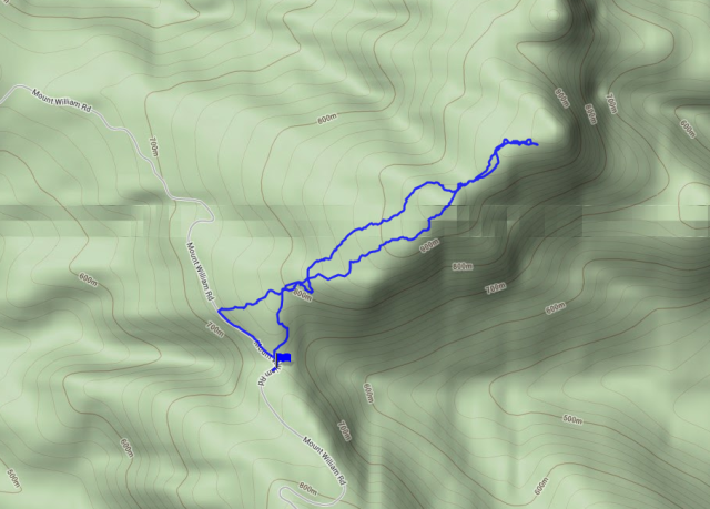
Here’s a screen shot of a GPS tracklog:

Track log to Twin Peaks and Mt Lubra

Track log to Twin Peaks and Mt Lubra

I headed off from the car park at the base of the Mt William walking track. A vehicle track is accessible a short distance south along the road. I headed along this until a T intersection, turned left and left the track about 20m south of there, heading generally west-south-west. You may notice that the return trip is a little more indirect, as I spent a little more time in the creeks. These have had much of their vegetation washed away a few years ago by heavy rains.

I would rate the forest as medium. It had it’s moments, but it never was really bad. My line approaching the saddle on the way up was not as good as the line on the way back.

From the saddle, I made my way up looking for access across two cliff lines to access the summit. Going about 200m further west than my approach and return from the saddle to the summit of VK3/VW-023 might avoid the cliffs all together. I made my way up in good time and set up the vertical antenna on top. I was hoping for 12m action on this trip, and got one contact. This was up in North Queensland. Good reports, which told me that the antenna is ok, but the large skip zone is not much chop. 12m for is going to rely on mostly direct wave contacts, not sky wave. Given most VK3 chasers with any 12m capability are around the Melbourne area, it will be nearby summits there that needed to clock up the 12m contacts. I still think that 12m is still a reasonable chance for DX into North America in the mornings.

After 12m, I went to 40m and worked the usual pile, both before and after UTC midnight. There has been some discussion about SOTA pileups in VK. I can generally work two to three a minute, and that is fast enough for handwriting on a pad while trying to be comfortable sitting on a rock. Of course, I never reward a station tailending before I call “QRZ”. The pile is well mannered though, and hopefully people feel they are getting worked fast enough. It’s also handy for “summit to summit” to be called, because as soon as I hear that, I call for those stations.

Here’s a view looking south from Twin Peaks:

South from Twin Peaks

South from Twin Peaks

Here’s looking east-south-east towards Major Mitchell Plateau:

Major Mitchell Plateau from Twin Peaks

Major Mitchell Plateau from Twin Peaks

Mt Warrinaburb/Lubra VK3/VW-004

With that, it was back down to the saddle to the north, and then head up to Mt Lubra. I noticed from Twin Peaks that a line of cliffs would block access going directly up from the saddle, so I would need to head to the left to be able to cross the cliff line. I was able to find this without too much trouble. It is a steep climb, but there were no real obstacle to typical Sierra Range progress of about 750m/hr. I went past the summit a little to a generally flat area about 50m beyond it and 5m down for a good spot to active.

I again set up the vertical, but had nothing on 12m. I worked the 40m pile and resolved to focus on 40m for the rest of the trip.

The tracklog shown at the top of this post shows my path back down. It is easier going downhill in medium scrub than going up. I made good time back to the car, and met a whole pile of people there who were participating in an event called the “Sierra Terror”.

Here’s looking south from Mt Lubra towards Twin Peaks and Mt Lang:

Twin Peaks and Mt Lang from Mt Lubra

Twin Peaks and Mt Lang from Mt Lubra

Red Man Bluff VK3/VW-002

From the car park at the base of the Mt William walking track, I headed north, and turned on to the Mt William Rd. I headed up to a saddle, and then a little more for a safer car park spot. I would then head over to the summit from here. Here is a projection of the tracklog:

GPS tracklog from Mt William Rd to Red Man Bluff

GPS tracklog from Mt William Rd to Red Man Bluff and return

The way up was in daylight, the way back about 1/3rd in daylight, 1/3rd in fading light and 1/3rd in the dark. The way back avoided most of the tough scrub, so Red Man Bluff need not be a difficult off track activation. This is the more western path shown on the tracklog, especially around the middle of the traverse to/from the summit. There is some moderate scrub to get started, but with a good line, it is not too bad. The way up was more difficult, it was slow going at times.

On Red Man Bluff, I switched over to using the end fed, as I was really now only trying for local contacts. Most were SOTA chasers, but a few from the VK Shires contest snuck in as well.

Of course there are always great views to be had:

Towards Halls Gap from Red Man Bluff

Towards Halls Gap from Red Man Bluff

Mt William VK3/VS-001

After getting back to the car, I drove to the end of the public road at the top Mt William car park. It’s 1.8km to the summit from here, and unlike some privilaged amateurs, I have no keys for the gate, so on foot we go. Here’s a tracklog screenshot:

Tracklog from Mt William upper car park to summit

Tracklog from Mt William upper car park to summit

It was now completely dark for the trip up and back. The lights of Stawell can be seen clearly from the summit, plus the glow of Ararat, as it is hidden behind some hills. There are some lights from the Melbourne suburbs that can be seen.

40m was no good for local contacts, even with the end-fed. The skip zone was taking out all of VK3, south east VK5 and VK2. It took quite some time to get my four QSOs. All were in either VK4 or VK6.

Next time I come up here in the dark, I might try the colinear on 2m and see if we can get some contacts into Melbourne.

I headed down to the car park and met a marshal involved with the “Sierra Terror” event. He reported that two walkers had gone missing on the walk down from the top Mt William carpark to the lower Mt William carpark. He had already walked the track in the dark to try and find them without success.

I wondered what I would do if there was to be a callout associated with that, given that my hiking overnight gear was back in Melbourne – I had no intention of using it on this trip. Regardless, it was time to get some sleep for the next two big days ahead.

This is continued in 2013 Grampians Queen’s Birthday trip Part 2

Regards,
Wayne VK3WAM

Mt Terrible and The Paps

Hi all,

Again, another chance to head for the hills. It is now getting a little more challenging to find summits within a reasonable distance of Melbourne that I have not activated before. There are only a few nearby ones that I have not yet activated at least once. Aside from the ones on private land, it is starting to get a bit scrappy. I have to travel further for fresh summits.

Today the plan was to go up the Mt Terrible Track as far as I could safely drive the 2wd car and activate Mt Terrible Spur VK3/VE-134, Mt Terrible itself VK3/VE-067, Bald Hill, VK3/VE-137 and The Paps VK3/VE-204.

Mt Terrible Spur VK3/VE-134

I decided to sleep at home and make an early start at about 4am and head up to make this summit just after sunrise. I arrived at Bald Gap at about 7:15 and started up the track. The track climbs steeply, and I was not able to get the car up the hill. It *might* be possible in a 2wd, but an AWD would have made it. It was only about 50m further where the road levelled off. So, out with the gear and I walked up to the summit. Of course, I always was going to have to walk the last bit anyway, but this would mean a long walk to Mt Terrible (and back).

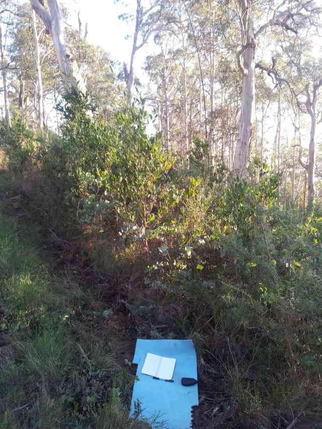
Because of the impending 25km return walk, I activated this summit quickly, working the pile up and then moving on. Here’s a pic of the operating location:

Operating location at Mt Terrible Spur VK3/VE-134

Operating location at Mt Terrible Spur VK3/VE-134

Mt Terrible VK3/VE-067

Now on foot, I tried to walk the 12.5km one way trip as quickly as possible. There were two other stations planned to be on, Marshall VK3MRG and Allen VK3HRA. Only one of these eventuated, and I was not at the summit on time. I ended up being a little late for my scheduled start time, but in order to not be very late for the following summit, I dispensed with putting up the vertical and used the end fed instead. When starting, my SWR was quite high, and I suspected this was because the Inverted V was not quite a V with the two sides pushed by trees to be close together for the first metre or so. I lowered the antenna by two segments on the squid pole and this worked quite well.

After working the pile up, it was QRT and back from where I came in order to activate Bald Hill.

Mt Terrible had a hut, but this has burnt down now (seems like it was a fire in the fireplace that got out of control – plenty of campers seem to like their fires a little too big.

Burnt down hut at Mt Terrible

Burnt down hut at Mt Terrible

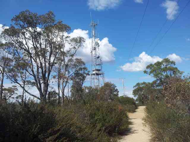
There is also a lookout tower at Mt Terrible with some comms gear on board:

Lookout tower at Mt Terrible

Lookout tower at Mt Terrible

Bald Hill VK3/VE-137

After a walk of the 12.5km back to VK3/VE-134 and then about 1km to the car, I had a quick bite to eat and then headed towards Bald Hill. I thought I might have to walk the whole way up, but I drove up to see how far I could get. I got most of the way and elected to stop before a ditch. The car could have got through for clearance, but it would have been too steep. Anyway, I was only about 200m from the summit, so this was a good place to get out anyway.

On walking up, the HT came alive on 2m with Marshall VK3MRG from Spion Kjope VK3/VT-040. I tried to work him, but the battery went dead. When I got to the summit, I pulled out FT-817 and called, but nothing heard. It was then time to setup the vertical and try to work the guys on Norfolk Island.

I started out working the pile on 40m, but signal reports were down. I then switched over to 20m to work the Norfolk Island guys, and noticed that I had the full tapped loading coil on when I was on 40m. No wonder signals were down on 40 with that big coil overloading the antenna. I was able to work both VK3CBV/9 and VK3QB/9 but they had to stop the pile trying to call them to get the QSOs. They are both keen to collect the chasing and summit to summit points. I had a nice SSB QSO with WA7JTM, which was easy going. It is difficult to get into Europe QRP, but the western parts of W seem much easier with a DX antenna. VK9NT have shown that if one can get their dipole 20m off the ground, then it works well DX. I might not want to carry a squid pole that big into the scrub!

In the end, I did work Marshall on VK3/VT-040, but he had to hang around there longer than perhaps he had planned.

The Paps VK3/VE-204

My final summit of the day was The Paps near Mansfield. I had looked at doing this summit before, but did not know the legalities of access. The road goes across private land, but I got a message last week from Warren VK3BYD, and the Parks Victoria ranger that the public is free to use this road, but the gates need to be left as found (generally closed). There is a gate both on the main highway and at the reserve end of the private land. The road across the private land is badly eroded, but a 2wd can be driven across it with care. The road has a few moments in the reserve, but I was able to drive the 2wd up to the beginning of the final climb up to the summit. I left the car here. The final climb is about 90 vertical metres up to the summit.

The road leaves the highway as marked for The Paps Rd in Forest Explorer. There is a sign on the highway with an arrow at this point.

The summit is quite barren up top. There is some communications gear and a trig point. I set up the squid pole in a vertical configuration on the trig point. It was dark when I began to operate. The VK3 stations were in the skip zone because of the time. Perhaps the end-fed would have worked better for them, but it was nice to pick up VK5 stations, plus a VK5 in Queensland. I also have a VE2 station in the log.

Things were quiet, and I was not getting any joy in getting to Europe, so I finished up and headed home. It was a long day and I was now a little tired, but still great to pick up 24 activator points, 12 chaser points and 16 summit to summit.

Regards, Wayne VK3WAM
Activation of Mt Dandenong, First Summit 2 Summit with Norfolk Island

Hi all,

Surprise activation

I was not planning to do an activation this day (Thursday the 9th of May), but some of the Dx-pedition team of VK9NT announced that they would activate Mt Bates VK9/NO-001, so it was a quick change of plans.

Getting out the vertical

It has been awhile since I have used the vertical on a SOTA activation. Most of the time these days I use the end-fed which works much better for local contacts, but once getting outside of 1000km, the vertical certainly starts to outperform the end-fed. Norfolk island is about 2300 km away, which for a single hop needs a reasonably low angle of radiation, hence the vertical is dusted off.

My vertical arrangement used to consist of 8 75cm aluminium segments above the feed point with guy ropes securing it at the 2nd and 4th segments. I added a loading coil, which improved performance on 40m. It’s tapped, so I also have points for 30m and 80m. I bypass it on anything shorter.

With the squid pole, I dispensed with 6 of the segments and the guy ropes. I attach a wire to the top of the squid pole and attach the other end to the top of the loading coil. The bottom two aluminium segments, plus my feed point (about 30cm off the ground) remain as per the old days. This arrangement takes about 15 minutes to set up 4 radials, which is enough to put me in business. It beats the 45 minutes the old arrangement used to take to set up. If there is any lull in proceedings, I then gradually lay out the remaining 4 radials.

Activating VK3/VC-025

After a short delay, I was on the air about 20 minutes after I was scheduled. I operated from a spot about 70m away from the summit restaurant, which was around 12 vertical metres down. I started off on 40m and worked the usuals. Signal reports were not too bad on the vertical, with many signal reports from 55 to 58 (for those that were sky wave). It’s not as good as the local reports on the end-fed, but certainly the vertical is working well today. I found VK9NT operators, but non SOTA, on 17m working their pile up. They were quite faint, so they were not likely to hear me, certainly amoung all the high power stations from the US calling them.

I saw on sotawatch that the VK9NT SOTA operators were up on 20m. I went over there, but it was a little tough with some QRM. Eventually they changed up 20 and I was able to work them. My QRP signal was weaker than many of the home stations came up on 20m, and it was a little difficult to get in there, with many familiar SOTA chasers working them, plus plenty more from NA and Europe. Quite a number of these were not specific SOTA chasers. They must have wanted the extra calls after working the non-SOTA VK9NT station.

After working VK3CBV/9 for the first ever VK9 summit to summit and VK3QB/9 right with him, I had a little more time. I called on 14.062 CW, just like the old days. Some nice strong 589 station coming in, and I was even getting 559 reports back. Not bad for QRP into W, and sometimes even my received report for QRP is better than what I hear them – which considering my <s1 noise floor is somewhat of an achievement.

Ahhhh for the days of SOTA DX and CW pile ups on 20m. Need to get those Euro and G s2s happening again. There's still an s2s outstanding to Andy MM0FMF.

The vertical at VK3/VC-025

Here’s a look at the setup:

Vertical antenna at Mt Dandenong

Vertical antenna at Mt Dandenong

And a closer look at the feed point, with the LDG tuner handing directly on the feedpoint. There’s an ugly balun on the radio side of the tuner. The 8 radials can clearly be seen in this pic, especially if you click on it.

Vertical antenna feedpoint

Vertical antenna feedpoint

Finally, looking up the squid pole. It’s a much easier configuration using the squid pole to provide most of the physical structure. The only reason I’m still using the aluminium sections is to a) have the feedpoint off the ground, and b) have the loading coil 1.5m above the feedpoint.

Looking up the vertical antenna above the loading coil

Looking up the vertical antenna above the loading coil

All in all, a nice satisfying afternoon.

73, Regards, Wayne VK3WAM

Pyrenees Trip

Hi all,

After my recent trip around VK1, I thought it time for something a little more conventional and a bit easier. I was heading up to Ballarat to spend time with family, but there is always some time for a little SOTA on the side. I thought I was good for two half days, but I was able to upgrade this to a day and half.

VK3/VC-032

First summit up was an unnamed summit between Ballan and Daylesford. There are a number of named summits in this area, but the highest ground is a little nondescript. Nonetheless, I had not activated this summit before, so it was one to add to the collection.

Access is quite easy, as many tracks are quite a good 2wd gravel standard. The high area consists of two hill tips with a shallow saddle between them. This saddle is less than 25m vertical down from the summit, so both hill tops (and the saddle as well) are in the activation zone, making it quite large. I picked an area near the top, set up the squid pole for 40m and got down to business.

Squid pole and end fed for 40m pictured when operating at VK3/VC-032

Operating at VK3/VC-032

VK3/VC-021

With this summit in the bag, it was time to check out Smeaton Hill. This is a private land summit. The owner lives in a house on the northern side of the hill. I dropped in and knocked on the door, but no one was home. End of this activation.

Mt Warrenheip VK3/VC-019

I still had enough time to swap in an alternative location. I had activated this summit the previous year, but it was still good for fresh activation points. A quick trip up, parking the car about 2/3rds of the way up. A simpler activation here than last year, just sticking up the end-fed, but no 20m CW action into Europe. Sometimes I miss the vertical, so I’ll need to get it out at some stage. It does not lend itself to doing many summits in one day, due to the setup and takedown time.

Mt Warrenheip has recently been burnt by fire, but the fire looks fairly mild. It got into the canopy of the trees, but the big trees should quickly recover.

With the activation done, my half day was up.

Blue Mountain VK3/VS-015

I then had a whole day to look at doing SOTA activations, so I thought I would try for 5 in one day. First up, Blue Mountain. This summit can be accessed from Glenlofty Warrenmang Rd, which heads through north-east to south-west through these hills. This is a good 2wd track, and about 997966, there is a 4wd track heading off to the west-north-west. This is passable in a 2wd with care. I was able to head through to 973977, where I left the car. This shaved off about 3km and was a nice little bonus. It was less than 1km from there to the summit. Here’s the operating shack:

Rig, cables and the feedpoint of the end-fed at VK3/VS-015

Operating at VK3/VS-015

And the squid pole:

End-fed mounted on a squid pole in forest at VK3/VS-015

Antenna at VK3/VS-015

One thing to note about these forests is how open they are. A stark contrast to the heavy bush bashing up in VK1 the previous weekend.

VK3/VS-018 Point 756/Pyrenees

Next up was a summit on the other side of Glenlofty Warrenmang Rd. This time it was a nice 2wd track heading up the hill, until I found a large tree across the road. Should I drive right out and come in the other side? After about 5 minutes, I thought I have to walk it – about 5km to the summit. I walked/jogged sections along this, trying to get to the summit before the UTC midnight changeover, for the eager chasers wanting to work the summit twice. I ended up on the air less than 2 minutes to go, where I worked 9 stations in the remaining time. I stayed for about 20 minutes after the UTC midnight changeover and worked most of them again.

One of the challenges of this trip was stretching the battery life over. I was using the leftovers that were unused from the VK1 trip – one 2.2Ah LiPo, plus the stock internal battery of the FT-817. This had to do all the four summits up to now, plus the 3 remaining summits. As of now, the 2.2Ah LiPO had done 4 summits, and was getting a little low, but still had a little left. The internal battery was still mostly fresh.

It’s nice to also clock up a few summits to summits (s2s) on this activation. These contacts always add a little buzz, and I’m even working my way up the s2s list here, although I really only target the activators points and especially uniques lists.

Time for another 5km march back to the car with the fallen tree. When I got there, there was another guy stuck there contemplating ringing up the local authority to get the road cleared.

VK3/VS-009 Ben Nevis

It was time to grab a quick bite and head up to Ben Nevis. This summit has a 2wd track that goes all the way to the top. I try to park out of the activation zone and walk in, rather than drive to the top and walk down and then up, where possible. There are two towers, plus a weather station up top. I headed over to a rocky area beyond that, which was a little higher.

Here’s some of the views:

Langi Ghiran and distant Grampains from Ben Nevis

Langi Ghiran and distant Grampains from Ben Nevis

Open plains NW from Ben Nevis

Looking NW from Ben Nevis

On commencing operations here, I got a first up distress call from VK3UP, who had come across a fallen motorcyclist near Mt Disappointment. It was also clear that many of the waiting SOTA chasers could not hear him. Andrew VK2UH could and he kindly took over handling the situation. Given that I was already stretching out the batteries, it was better for a home station to handle this. Andrew arranged the calling of the ambulance to help, and then had to relay comms for emergency services as they were unable to communicate themselves from the location of the accident.

I headed up 5kHz and activated the summit from there. It was a smaller chasing crowd – I presume some of the usuals were listening in to the emergency situation 5kHz down on the calling frequency. There was no problems experienced from the commercial gear up on the summit.

Here’s a look at the main tower at Ben Nevis:

Main commercial tower and fire lookout at Ben Nevis

Main commercial tower and fire lookout at Ben Nevis

Mt Cole VK3/VS-008

Mt Cole is a tricky little summit. It does not have 2wd road access, so I tried going down a rough track starting at 012668, so I could approach the summit without having to do too much climbing. This track is really too rough for a 2wd. It would have been better to park at 018667 and walk from there. Frees Point Rd could be used, but I headed up off track, basically going up the spur.

Upon reaching the top, I put up the end fed as usual, but then noticed that the UHF connector had come apart – basically a break in the centre conductor near the crimp joint through repeated stresses over time. I put the other end of the coax into the end-fed match box for a secure connection and got out the pocket knife to do something at the radio end, and this is what I came up with:

Coax stripped back going directly into the UHF connector on a FT-817

Jury rig job to get on the air 40m without a connector

It was a bit fragile, especially if I moved, I might have moved sticks, grasses or whatever that would affect the connection. I had to break here and there, but I got the activation done.

Time was pressing on, but the power side was still holding up. I had the chance for one last activation, after returning to the car and finding out I had not trashed it on that rough 4wd track.

Mt Lonarch VK3/VS-013

The final activation of the day was a nice easy one. The road goes all the way, but it actually goes past and loops back. I parked about 40m vertical down from the top and “bush-bashed” over to the summit. It was not real bush-bashing because the forest is quite open with a grassy forest floor. Again, I had to rely on the jury-rigged cable to bring the activation home, but it worked.

I also walked out with around about 45 minutes of operating time still up my sleeve. The 2.2Ah LiPO could have still been used for another 1/4 of an hour and the internal battery was only about 2/3rds used. So 7 summits out of one 2.2Ah battery plus a bit of internal battery top up is not bad going! Total operating time would have been over 3 hours with still 3/4 of an hour in the bag.

It is interesting these days to work 40m. Certainly there are some nice decent pile-ups happening, but operators are waiting in turn. Hopefully we keep things going well in conducting the dog-piles and the chasers are patient with new activators who perhaps might not be used to having 5 stations answer their CQ all at once. It is still a far cry from the days early last year where one could activate a summit for SOTA, and call CQ for an hour and have no one come back. Things are better these days.

Nice to get 7 summits, with 6 new ones in. I’m now only three new summits away from 100 unique summits.

73, regards, Wayne VK3WAM

4 summit activation around Mt Dom Dom

Hi all,

Again, it’s time to head for the hills and get into some of that SOTA good oil. For this series of activations, I wanted to have a good look at 2m again, and the colinear was planned to see a lot of action. I did take the end fed for 40m, but the plan was to only use it if I could not get 4 contacts on each summit. We’ll see how things go.

Mt Vinegar VK3/VC-005

This summit is between Dom Dom saddle and Mt Donna Buang. From either place, it would take some time to get in, and this was my original plan. On looking at maps, I thought I might be able to get closer access from Acheron Way, and this proved to be the case.

Access can be via Caters Gap Rd and this is a forest road with large aggregate. Forest Explorer shows it becoming a 4wd track, but the road quality remains good. I thought I would use the Cleft Rock Walking Track, but could not find it. That area had been subject to recent logging, so the track would have been destroyed anyway. I proceeded to point 825356 and turned left, to head up the hill. This went through a logging area, but the track remained passable for a 2wd without too much difficulty. I climbed up the mountain and parked about 843345. I could have gone about another 500m before a locked gate about 1km from the summit. In any case, it was a much shorter walk than I had anticipated.

I put up the colinear and called on 146.5 FM. This was going to be the most difficult summit out of the three that I had planned for the day as Mt Vinegar is hidden from Melbourne by a few closer hills that are part of the Donna Buang system. Even on VK3REC, a EMDRC repeater, action was slow – but this was not because I could not reach it. Perhaps people were slow out of bed today. I was able to reach the repeater with just a HT with a 1/4 wave antenna, so I was able to keep the FT-817 on the colinear. I eventually had to try 144.1 SSB to get the 4th contact. The stub I have for the antenna gives a good SWR at 144.1, so it is good to see that this project has obtained a good result.

Here’s the operating location at Mt Vinegar:

Operating location at Mt Vinegar showing a squid pole. 2m colinear, a backpack, a FT-817 and other radio gear

Operating location at Mt Vinegar

When operating, it’s always nice to have a good rock to sit on:

The shack at Mt Vinegar showing a rock to sit on, plus the pack, a Wouxun HT, a Yeasu FT-817 and other gear

The shack at Mt Vinegar

With the car closer than planned, I thought I might be able to get to Mt Gordon a little before 11am for the UTC midnight change over.

Mt Gordon VK3/VN-027

This summit is part of the 2013 batch to join the SOTA program in Victoria. It is a summit located between Marysville and Narbethong. Access is via a 2wd track that heads off to the north from Marysville Rd which is shown in Forest Explorer as a 4wd track.

There is some commercial gear at the summit as shown below:

Commercial towers at Mt Gordon

Commercial towers at Mt Gordon

With these commercial towers, I imagined that I would suffer from QRM problems with overloaded frontends and it proved to be the case. The colinear is fantastic at bringing in weak signals, but the downside is an overloaded FT-817 front end. With the FT-817 overloaded, there was no point trying the Wouxun HT.

I was able to get two contacts before 11am, and a good number afterwards. I had enough FM contacts to get the SOTA activation points, but sometimes it took some patience. I was getting into Melbourne well enough, but the QRM would take out the readability of other stations. It came and went, and when it was absent, I had a sub s1 noise floor.

A nice touch at the end was getting VK3PF on SSB at 146.475 This frequency is turning out to be a SOTA vertical SSB frequency of choice, just a little down from the national FM calling frequency. I still go down to 144.1 for the SSB chasers down there still, although most of those have horizontal antennas at that frequency, so there’s a bit of a mismatch with my vertical colinear.

Here’s a look through some of the regrowth (and cooked dead trees) towards Marysville from the summit:

Marysville from Mt Gordon, with some dead trees in the foreground. The slopes of Lake Mountain can be seen in the background

Marysville from Mt Gordon

Here was a good view of the Cathedral Ranges from Mt Gordon:

Cathedral Ranges from Mt Gordon

Cathedral Ranges from Mt Gordon

Mt Dom Dom VK3/VN-017

Call me irrational, but a high profile search from a few years ago had me edgy about this place. Still, Mt Dom Dom likely to be the easiest of the three summits to activate on 2m, so the HF antenna would remain unused. I headed in from Dom Dom saddle to about point 813382 on what is marked a 4wd track but is a narrow but good 2wd track. The point where I left the car is about where Forest Explorer shows a walking track. This walking track does not exist. The southern side of Mt Dom Dom has been logged in recent years, so the growth is not too bad. I headed up the side of the mountain “following my nose”. Most of the time it was ok. I think the best approach is to head up the middle on any old logging vehicle tracks that still exist. In a few years, the whole place will be overgrown and access will have to be via the more mature forest on either side of the recently logged areas.

Here’s a look at my operating location there:

Operating location at Mt Dom Dom showing the squid pole and radio gear

Operating location at Mt Dom Dom

Action was still a little slow from Mt Dom Dom. I was getting strong reports from those who did come up from Melbourne, but there were not too many of them.

Got a nice view looking back towards Melbourne from near the summit. See if you can find my car:

Watt River valley and Melbourne from Mt Dom Dom

Watt River valley and Melbourne from Mt Dom Dom

A highlight of this activation was a QSO with Glenn VK3YY on Britannia Range VK3/VC-011. Mt Donna Buang is in the way, but we were able to get the QSO home on SSB. I’ll need to find out from Glenn what antenna he was using.

Mt Toolebewong VK3/VC-033

My final activation was actually an unplanned one, but because I was running ahead of schedule, I was able to put in for a bonus summit. Signals from here were stronger into Melbourne, as more paths were unobstructed. I had a lucky one at the end with Peter VK3ZPF, who called on 146.5 halfway through packing up, but I left the HT on. We were able to exchange reports, but I still had the colinear up in the air. This allowed us to compare the 1/4 wave “rubber ducky” with the colinear. Both ways were significantly up with the colinear.

And with that, it was time to head for home. A nice day with 4 new summits to add to the uniques collection and 18 SOTA points.

Regards, Wayne VK3WAM

SOTA activations of VK3/VG-107 and VK3/VG-121

Hi all,

On a recent trip to Mitchell River National Park, I had the opportunity on the Sunday to head out and activate a couple of Summits on the Air peaks that were nearby (but not actually in the park). Both VK3/VG-107 and VK3/VG-121 are on a ridge that comes in towards Angusvale, which is where we were camping. I headed out alone, but intended to be back before a late lunch.

VK3/VG-107

This is an unnamed summit that is to the north and east of the Dargo road. I approached from the east, although there may be closer access from the west. There is a 4wd track heading along the ridge. A proper 4wd with reasonable clearance and low range would be needed to access the summit along that route, but the west access may be better. I found a track that loops underneath to the south of the summit that looked quite high grade, almost 2wd. I did not follow this, so I don’t know if it is that standard all the way to the road.

The 4wd track follows the contours that are quite up and down. It was about 9km from where I parked the car on the boundary of the national park to the summit, which included passing VK3/VG-121, which I activated on the return. Conditions at the start of the day were quite mild, but the heat started building up. I had hoped to activate the summit on both sides of UTC midnight, but it became clear that I would not make it in time, due to both a late start, and slower progress as a result of the constant ups and downs. In the end, I desired most to get the 4 activator points rather than worrying about maximising summit to summit points from double dipping on UTC midnight.

Here’s a pic from where I activated, just a little down from the summit on the north-east side:

Activating VK3/VG-107

Activating VK3/VG-107

SOTA has certainly come along. Gone are the days of calling CQ for 20 minutes without anything coming back. Now, I can expect a few waiting for me, and then at least 10 more stations responding to “QRZ, QRZ” along the way. If the band is at least a little open, getting a summit activated on 40m is not too much of a challenge these days. On the positive side, it is good to see the increasing numbers of both activators and chasers. A number of chasers are getting tempted to activate.

VK3/VG-121

With the increasing heat, I felt I needed to get moving back towards the car, and VK3/VG-121 was along the way. I am glad I passed it on the way out, as this meant less walking in the heat of the day. I was also a little low on water, because of the heat. I arrived a little later than planned and set down to operate on 40m using the end-fed, just like my earlier activation on vk3/vg-121. Again, the activation went quite quickly with plenty of stations calling. One station remarked that SOTA is quite good for F-calls. Some F-calls have observed that many people do not answer their calls, presumably because of their F-call license. On SOTA, there are no such problems. It is pleasing to see that SOTA is changing the culture of Amateur Radio for the better.

Speaking of F-calls, Rob VK3DN introduced me to Aldo VK3FADG. He was freshly licensed and was with Rob and others from the EMDRC who were holding an Amateur Radio exhibition over the weekend. I completed Aldo’s first SOTA QSO, which was also his very first Amateur Radio QSO. He was so fresh he did not know yet what QSO or 73 meant (QSO is a conversation and 73 is best regards for those who don’t know 🙂 ). Again, good to see that SOTA is out there being noticed, and even attracting people to Amateur Radio.

While up there, I learned that Peter VK3PF had acquired the 1000 chaser points to become a Shack Sloth. Congratulations Peter on Slothdom, and enjoy the ice block. I could have done with an iceblock today!

There were still stations calling more than 1/2 an hour later, but I knew it was 50 minutes back to the car, and I was out of water. Time to get out of there. I took a quick pic near the summit looking west from where I had come from VK3/VG-107:

Looking west from VK3/VG-107

Looking west from VK3/VG-107

When I got back to camp, I drunk more than 2 litres, so I certainly needed some more water!

73, regards, Wayne VK3WAM